Le Circaète (Circaetus – « Snake Eagle »)
This itinerary reminds the wide-open spaces, so well represented by the large birds of prey flying over vast territories and reassuring us with their presence in the preservation of nature.
Description
Signs: Yellow and the orange circaète eagle
From the sign in the village, take the D43 downhill.
After a turn on the right, turn left for 50m/164ft towards La Salle. Then take the earth track going up. At the top, turn left onto the small tarred road. Leave the road leading to La Salle on the right and follow the path.
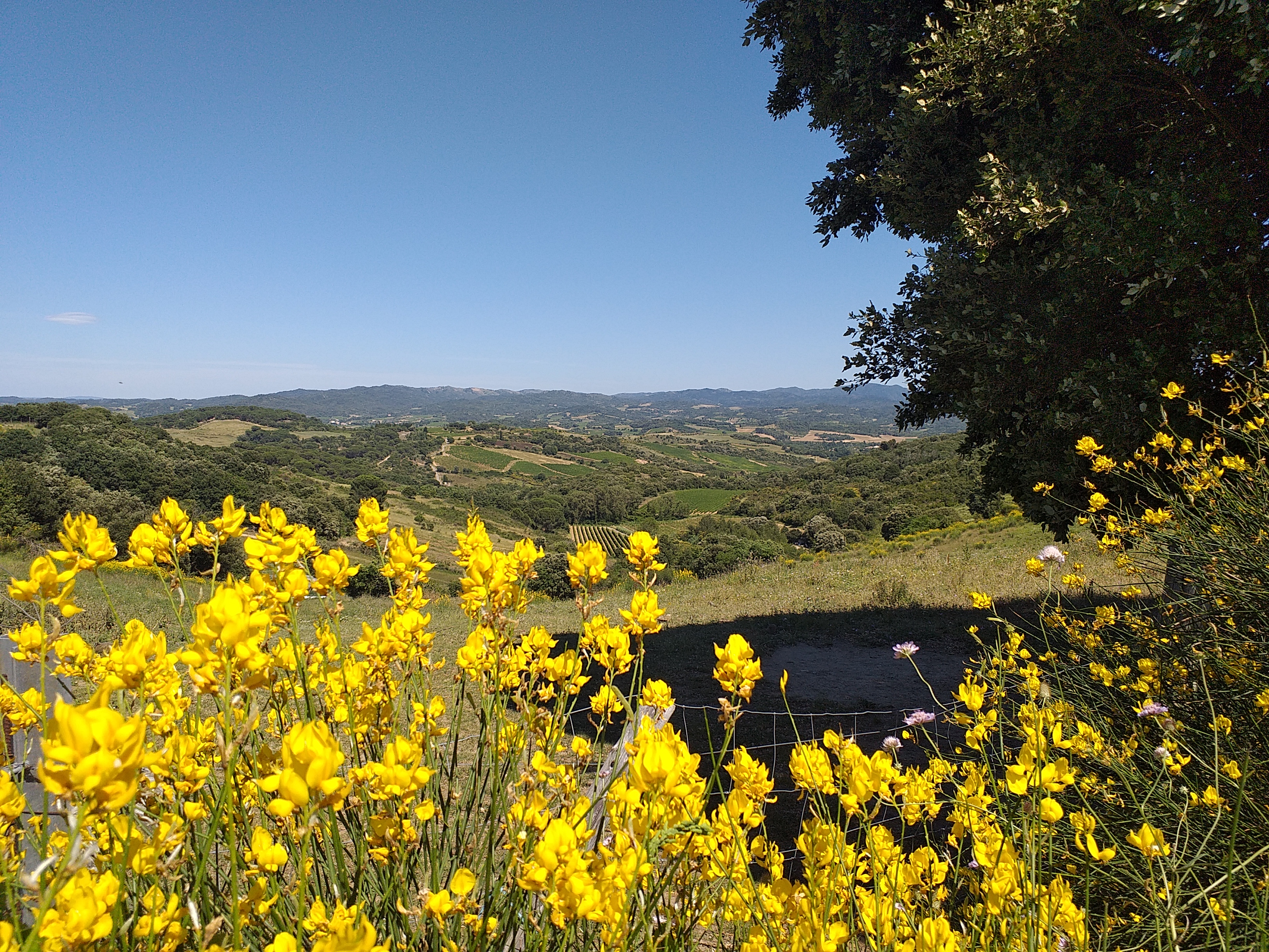
At the crossroads of tracks, continue to the right in the direction of the crest line along the vineyard. Viewpoint on the left on Carcassonne and on the other side on the place called "Arnauteuille" and the village of Montclar further to the right.
The vineyard gives way further on to a thicket of holm oaks. In the undergrowth, there is fragon and along the path these cistus, blue carnations of Montpellier (small blue flowers, thin and tall stems), sweet peas (pink and white. Pass in front of the magnificent holm oak (Auzina in Occitan) where wild boars rub to get rid of parasites. The traces of mud left by the animals are permanent on the trunk.
Further on, turn right and go down.
Take the small marked path, more pleasant than the previous one. The “asphalt grass” (its name comes from the smell it gives off when you crumple it) colonizes the edge of the path (opposite).
Turn right at the crossroads, the path goes uphill and ends with a small steep slope leading you to the arboretum. At the very bottom, cross the brook and don't miss this small detour of 30 meters which leads you to a waterfall, a cool and humid place, colonized by horsetail and also occupied by a variety of fern, "le capillaire" (Maidenhair spleenwort).
Take the path again and go up to the road D43, cross and turn left for about 120m/400ft. Take the upward path which leads to the Pech de Gabarre.
At the junction with the track, turn right and follow this ridge overlooking the campsite. A nice view on the left, over Limoux and its tile factory (the big roof). The path climbs on the left quite abruptly, then descends steeply with, in the hollow, a muddy part. Continue on the highest path in the undergrowth. Strong rise on a gullied path.
At the highest point of the route, don't miss this little detour to the left which offers a panoramic view on the Pyrenees. Go back to the forest crossroads and go down the gravel track (steep descent) which runs along the lower part of the cereal crops where the harrier often flies.
At the river, turn right. A steep ascent to the village. A drinking water tap is available in the parking lot on the other side of the road. After taking a breath, you will be able to walk through the streets of the circular village called "circulade".
- Departure : MONTCLAR - Car park on the D43 road
- Arrival : MONTCLAR - Car park on the D43 road
- Towns crossed : Montclar, Preixan, Rouffiac-d'Aude, Pomas, and Cépie
Forecast
Altimetric profile
Access and parking
From the sign in the village, take the D43 downhill.
Report a problem or an error
If you have found an error on this page or if you have noticed any problems during your hike, please report them to us here:
Close by9
- Wine cellars and local produce
- Restaurants
- Accommodation